-
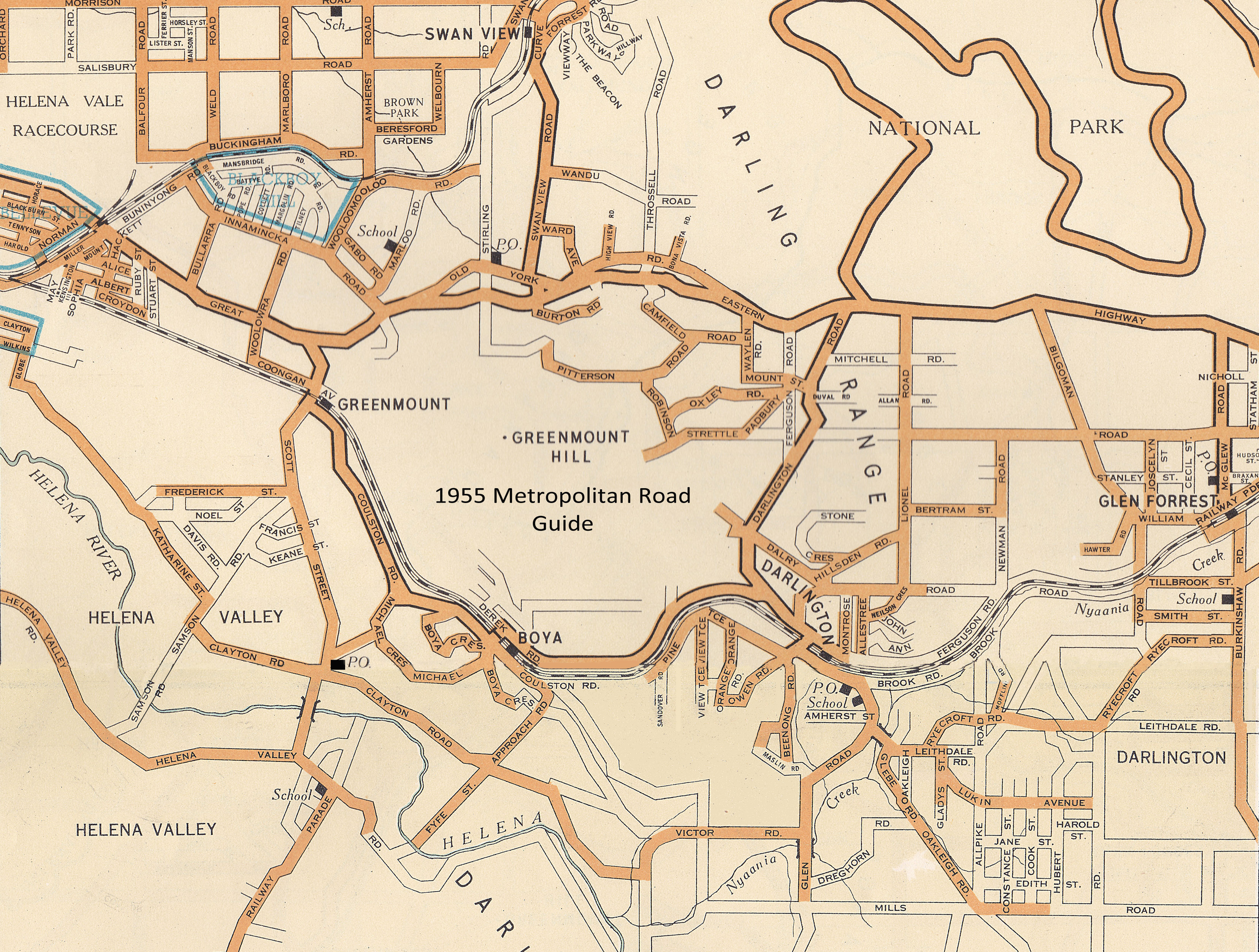
Darlington Memoirs
- James Oxley (pdf) NEW!
- Jane Ashbury (pdf)
- Les Ashton (pdf)
- Barbara Curmi (pdf)
- The Mofflin Family
- Mofflin child's lives (pdf)
- Edna Goodwin (pdf)
- Sally Herzfeld (pdf)
- Findlay Kidman (pdf)
- Pip Newman, (pdf)
- Prater Family
- Bev Prater
- Shirley Pepper
- Richard Sadleir (pdf)
- Kathleen Skipsey(pdf)
- Ida Smith (pdf)
- Trevor Tuckfield (pdf)
- Mary (Mollie) Skinner
- Peter Morrison's memoirs
-
Pioneer Families
-
Interesting Personalities
-
WW1 Soldiers
- WW1 Honour Board
- Francis Cockshott
- Reginald Cockshott
- Charles Daniel
- Robert Dinning
- Frederick Dinning
- Frank Davis
- Frank Gibson
- Charles Good
- Theodore Jacoby
- Reuben Mehew
- Charles Mumme
- Horace Wilson
- Matthew Wilks
- Edward Wilks
- Norman Wheatcroft
Soldiers who
lived in Darlington
after the war
-
WW2 onward Soldiers
- Complete Soldier List
- WW2 onward Honour Bd
- Abbott Family
- Alan Stringer
- Archibald Stanley Williams
- Arkell Family
- Barnett
- Colin Keast
- Cynthia Neville
- Eric Callow
- Ernest Grigg
- Eric Smith
- Herbert Mofflin
- Geoff Palmer
- George Bishop
- Women in the VAD
- James De Turt
- John Hartney
- Jones William
- Leith Smith
- Max Stephenson
- NAA photos (1 of 2)
- NAA photos (2 of 2)
- William Robertson
- Roy Harris
- Robin Thoy
- William Browder
-
Education/Schools
- Allambee - Bernice Hoult
- Darlington Prim School - 1st 70 yrs (pdf)
- Diana Warnock (pdf)
- History of the Helena School
- The Darlington Primary SchoolThe words and tune were written by
Chris Durrant in 1982 (for the school's 70th)
and performed here in 2019 by
Ms MacKay's Year 1 & 2 classes.
song (click the player below)
-
Shops & Businesses
- Tearooms & Post Office (pdf)
- The Darlington Bakery (pdf)
Grevillea Tearooms
Montrose Ave Store Shopkeepers
-
Accommodation
-
Early Artists
-
Churches & Clergy
-
Community Groups
-
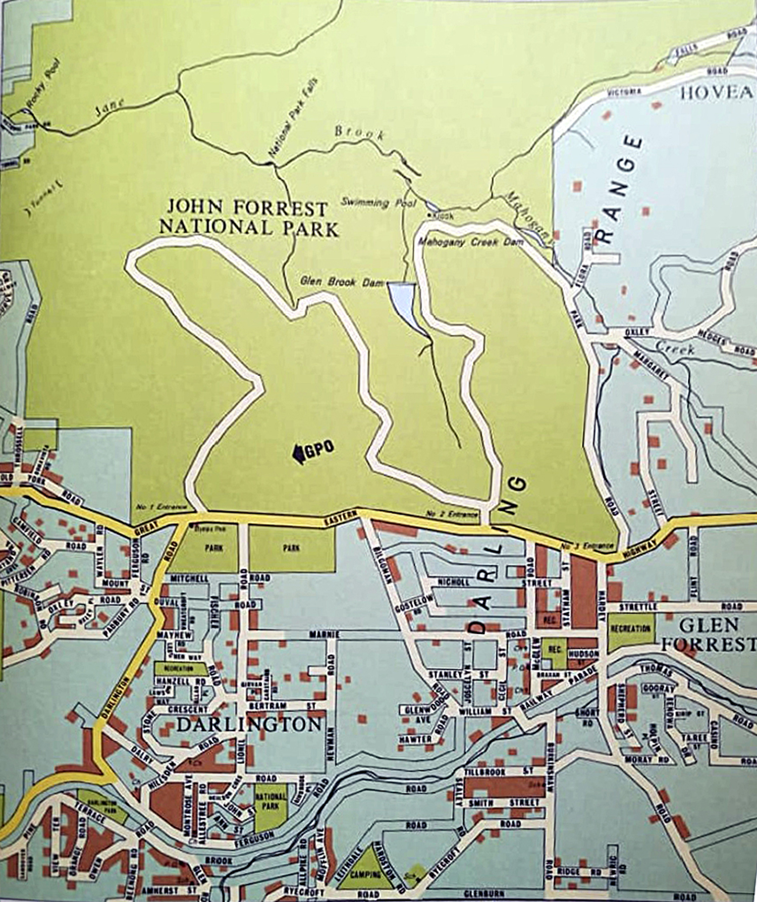
Reserves & Parks
-
Eastern Railway
-
Talks (Audio)
- Pauline Fischer (1992)
- Darlington Theatre Players (2013)
- History of DAF (2013)
- Lindsay & Stuart Silbert (2015)
- Goldf'ds Pipeline Bill Cutler (2016)
- Doug Love (2016)
- R. Hyner & R. Woldendorp (2017)
- Trea Wiltshire (2018)
- Ron Mitchell Bilgoman Well (2018)
- Richard Palmer/Coleman (2019)
- Sally Herzfeld (2021)
- Tom Herzfeld (2021)