Point of Interest # 11
SMITH'S MILL/GLEN FORREST RAILWAY STATION
The narrow gauge Eastern Railway line reached Smith's Mill in 1884 and as the original name implies, timber from the mill was the first produce to be transported down to Perth and Fremantle. After the timber was cut out and the mill dismantled, Glen Forrest (as the name changed to in 1915) railway station provided access for passengers, produce and livestock into and out of the district. The railway was critical for businesses and commuters as private transport, except by horse and cart, was not available until the early 1920s, and then mainly for the 'townies'.
Glen Forrest Station was a 'block' station, which means that the Station-master controlled trains running between Bellevue and Mundaring, using the electric staff system [1]. The railway line was only ever 1 track, therefore safety was important and although there were no incidents of train meeting train, there were instances of runaway trains through Glen Forrest.
Between Glen Forrest and Darlington there were the 'Deviation Inclines', a series of additional embankments and cuttings required to avoid the 'Devil's Terror' area, the latter causing a delay and adding costs to the construction of the line. The 'Devil's Terror' was a cutting, to the north of the current walk trail, that encountered pipe clay which was unable to sustain the weight of a train or even a railway line. Even so, the 'Deviation Inclines' were still boggy and in winter train passengers recalled leaning out of the windows to see clay oozing out from beneath the sleepers as the train passed over. Many times, in winter months, trains stalled on the line and had to reverse back and sand the rails to get traction.
The railway yard comprised multiple tracks where produce was loaded/unloaded and trains marshalled to their loads, as well as a spur line from the sidings, leading south westward to Burkinshaw's gravel and clay pits, located close to Burkinshaw Road (POI #6). Railway fettlers and other such track maintenance staff were based at Glen Forrest and they ranged up and down the track, keeping the railway operational.
The line closed in January, 1954 (against the protests of local commuters) due to the better grades and heavier loads that could be carried via the northern and mis-named 'Mahogany Creek Deviation' double-track narrow gauge line that passed through Swan View, Hovea, Parkerville and Stoneville. The railways earned more revenue from freight than passenger traffic, hence the reason for closure. In 1966, the northern route was itself closed when the Avon Valley standard gauge line came into operation (and continues today).
The railway reserve, as the original railway land became known, remained dormant for many years after it was vested in the Shire in the 1960s. Now the reserve continues to be used for telecommunication, power, cycling and walking trails and other uses. Some railway paraphenalia still remain along the old line, such as telegraph poles and concrete signal footings. The signal in the Morgan John Morgan Park is not in it's original position, just so you know . . .

Glen Forrest Railway Station and Yard, from an original WAGR drawing. (scroll to the right to see the full drawing and use the magnifying glass to zoom in.)
NOTE: If the zoom function isn't working, reload the page to fix it.
 Glen Forrest Station (front).jpg)
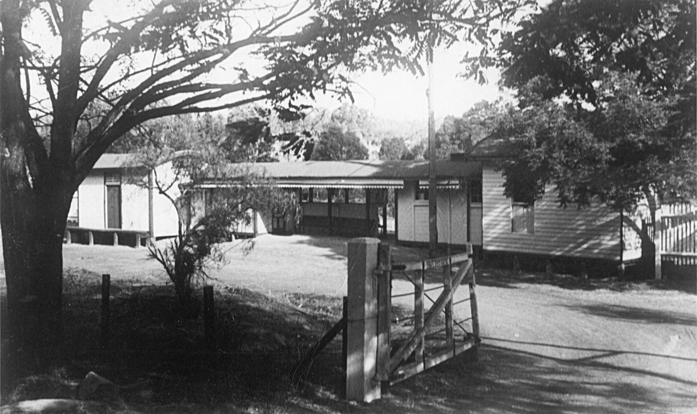
Glen Forrest Railway Station c1950s, looking east.
Courtesy: Lindsay Richardson.
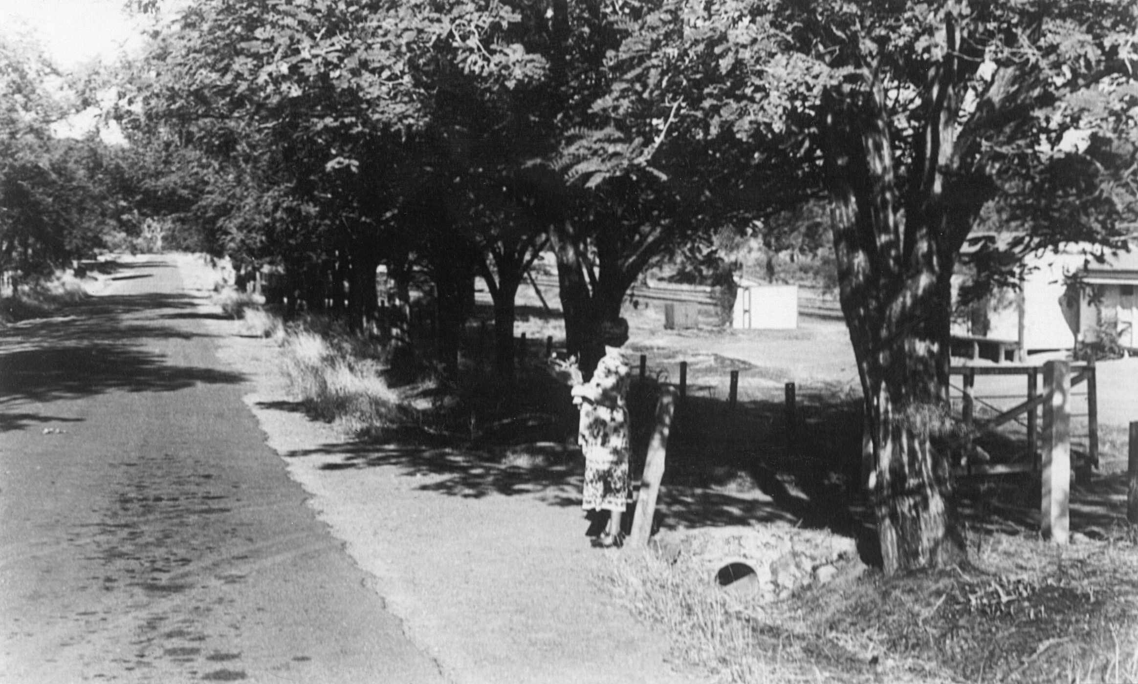
Glen Forrest Railway Station entry, from Railway Parade, looking east.
Courtesy: Lindsay Richardson.
Glen Forrest Railway Station entry from Railway Parade.
Courtesy: Islay Kelly, Mundaring & Hills Historical Society.
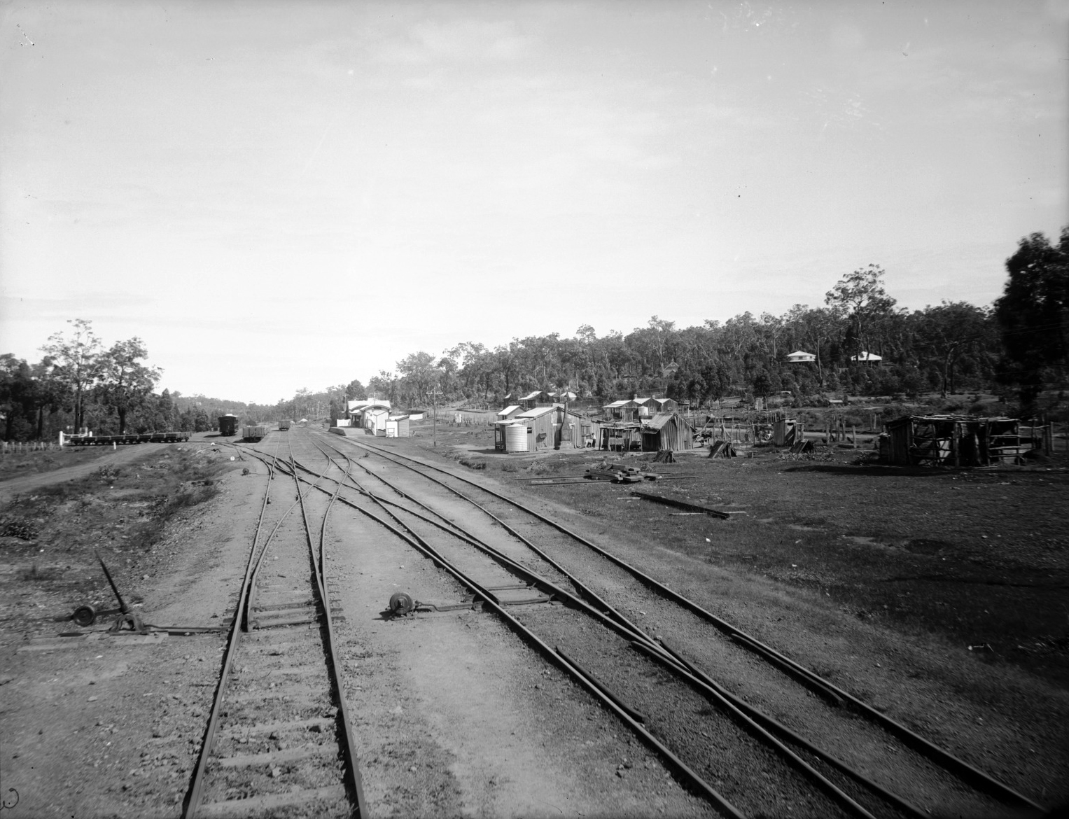
Glen Forrest Railway Station, c1906, looking west.
Note the rake of wagons on the left-hand side, with a white gate in front. These wagons are standing on the spur line to Burkinshaw's gravel and clay pits, leading south west refer to POI #6.
POI #14; the church, POI #15; the Octagonal Hall and POI #16; the Post Office, are all visible in the background, amongst the trees.
Courtesy: SLWA, B2534391_2.
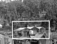
Butcher's Shop.
Smith's Mill had a butcher's shop that burnt down in the 1930s, where the current Gift Shop (POI #12) stands. An enlargement of the railway yard photo shows the Burcher's shop outlined in white for clarity.
Courtesy: SLWA, B2534391_2.
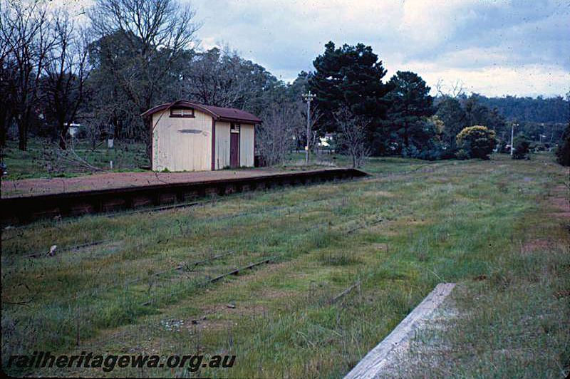
Glen Forrest Railway Station, looking north-east, c1965, long after closure, showing the Goods Shed, telephone pole and distant signal still standing.
Courtesy: Rail Heritage WA.
[1] On a single line, the crew on each train intending to travel along a defined section of the line (for example: Bellevue to Glen Forrest would be one section and Glen Forrest to Mundaring would be another section, with Bellevue, Glen Forrest and Mundaring stations being block stations) had to collect a staff, a metal baton-like instrument, from a block station to authorise that train to be on that line section. At the next block station, the crew returned the staff. Any train travelling in the opposite direction had to wait at the next block station (up of down) until this staff was received at that block station before proceeding, thus ensuring there could be no more than one train on the line at any one time.
© Copyright 2020 Rob Borsje, Lyn Myles, Mary Richmond and attributed sources.